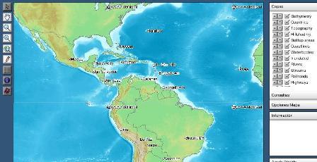
Wfs

OpenJUMP v.1. 4. 2002
OpenJUMP is an open source Geographic Information System (GIS), it can read and write shapefiles and simple GML files. It has limited support for the display of images and good support for showing data retrieved from WFS and WMS web-services.
OGC2SOA v.rc
The goal of this project is to provide WSDL/SOAP wrapping services for OGC WMS, WFS and WCS in order to orchestrate them with a SOAP orchestration engine.
Spigve v.0.0.1
Cliente de web mapping, basado en GeoClient y desarrollado en EcmaScript/JavaScript sobre SVG, que permite consumir servicios OGC/WFS para publicacion de Informacin Geogrfica utilizando graficos vectoriales.
SUAS MapServer v.3.21.1213.beta1
PHP based Web Map Service (WMS) and WFS implementation according to OGC's specification.
AutoDEM
AutoDEM (aka as AutoMNT) is a freeware GIS software to create Digital Elevation Models (DEM) from scanned topographic maps for Windows. Through different data layers (map, contours, DEM, etc.
Cadcorp SIS Map Browser v.7 1
Cadcorp Map Browser is an application which allows the user to browse OGC® standard geographic data served on the web. Global demand for open systems interoperability is accelerating. Open Geospatial Consortium, Inc.
GeoServer v.2.2.3
GeoServer is an Open Source server that will allow you to connect your information to the Geospatial Web.
TatukGIS Viewer v.2.9.0.5307
TatukGIS Viewer opens most GIS/CAD vector, raster image, and grid file types, including the aerial imagery and vector street map data provided by the leading vendors, most ArcView, ArcExplorer, and MapInfo projects,
Quantum GIS v.1.8.0
Cross-platform and user friendly Open Source Geographic Information System (GIS). Quantum GIS (QGIS) is a user friendly Open Source Geographic Information System (GIS) that runs on Linux, Unix, Mac OSX, and Windows. QGIS supports vector, raster,
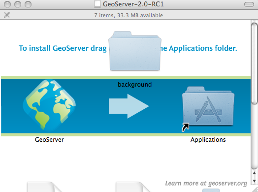
GeoServer for Mac v.2.2.3
GeoServer for Mac is an Open Source server that will allow you to connect your information to the Geospatial Web.